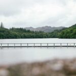
Rannoch Moor (Scottish Gaelic: Mòinteach Raineach) is a vast upland blanket bog covering approximately 50 square miles (130 km²) of the central Scottish Highlands, spanning parts of Perth and Kinross, Argyll and Bute, and Highland. It is designated a Special Area of Conservation and is one of the largest surviving wild landscapes in the British Isles. This guide covers access and entry, how to get there, parking, safety, and practical advice for planning a visit.
Last updated: May 2026. The easiest way to visit is on a Loch Ness day tour from Edinburgh.
Quick facts
| Detail | Information |
|---|---|
| Location | Perth and Kinross / Argyll and Bute / Highland, Scotland |
| Main road access | A82 (Bridge of Orchy to Glencoe) |
| Eastern access by road | B846 from Kinloch Rannoch to Rannoch Station |
| Eastern access by train | West Highland Line to Rannoch Station (ScotRail) |
| Admission | Free (open access under Scottish Outdoor Access legislation) |
| Facilities | Basic at Rannoch Station only; none on the open moor |
| OS Map | Landranger 41 and 50; Explorer 378 and 385 |
| Typical visit length | Half day to full day; overnight expeditions possible |
| Altitude | Moor floor c.300–350m; surrounding peaks 600–900m+ |
| Designation | Special Area of Conservation; SSSI; National Heritage site |
Access to Rannoch Moor
Rannoch Moor is freely accessible under the Land Reform (Scotland) Act 2003, which gives everyone the right to be on most land and inland water in Scotland, provided they do so responsibly in accordance with the Scottish Outdoor Access Code. There are no entry charges, no tickets, and no booking requirements for the open moor.
The moor is not managed by a single organisation. Different sections fall under the stewardship of NatureScot, Forestry and Land Scotland, private sporting estates, and the Crown Estate. Conservation designations protect the habitat; visitors should stay on established paths where possible, avoid disturbing ground-nesting birds (April to July in particular), and carry all litter out with them.
How to get to Rannoch Moor
There are two main approaches: from the west via the A82, and from the east via the B846 to Rannoch Station.
By car from the west (A82): The A82 between Bridge of Orchy and Glencoe crosses the western fringe of Rannoch Moor. Driving north from Glasgow via the A82, Bridge of Orchy is reached in approximately 1 hour 40 minutes. The road continues across the moor towards Kings House and Glencoe. Key stopping and parking points along this route include Bridge of Orchy and the Ba Bridge layby area.
By car from the east (B846): From Pitlochry, take the B8019/B846 west through Tummel Bridge and Kinloch Rannoch to reach Rannoch Station at the end of the public road, approximately 40 minutes from Pitlochry and around 1 hour 15 minutes from Perth. This is the most isolated road-accessible point on the moor’s eastern edge.
By train to Rannoch Station: The West Highland Line (ScotRail) from Glasgow Queen Street stops at Rannoch Station. The journey from Glasgow takes approximately 3 hours 15 minutes. Trains also stop at Bridge of Orchy, one stop south on the same line. There are no ticket machines at either station; buy tickets in advance via scotrail.co.uk or from the guard on the train. Sunday services are limited; check the timetable before travelling.
Important: Rannoch Station is only accessible by the single-track B846 or by train. There is no other public road to the station. Mobile phone signal is absent across most of the moor and unreliable at the station itself.
Parking at Rannoch Moor access points
At Rannoch Station, a free car park is available. There is no time restriction. Toilets at the station are open 24 hours a day, 365 days a year.
At Bridge of Orchy, a small car park is available beside the hotel. This is the most convenient starting point for walks into the western moor and for those following the West Highland Way.
Along the A82, several laybys provide informal stopping points for views across the moor. The Ba Bridge area (between Bridge of Orchy and Kings House) has a popular roadside stopping point.
How long to spend at Rannoch Moor
The time spent depends entirely on what you plan to do. For a road-based visit and a short walk from the A82 or Rannoch Station, allow two to four hours. For the popular linear walk from Rannoch Station to Corrour Station (9 miles one way), allow five to six hours with a return by train from Corrour. Longer multi-day expeditions are possible but require full wilderness planning and navigation skills.
The moor is not a place to rush. Weather, terrain, and distance make it unsuitable for tight schedules.
Safety on Rannoch Moor
Rannoch Moor is one of the most serious remote environments in the British Isles. Underestimating its hazards has resulted in emergency call-outs and fatalities. The following precautions are essential for any visit beyond the immediate roadside:
Navigation: There are very few waymarked paths on the open moor. The ability to navigate by map and compass is essential for any route away from established trails. Carry the relevant OS 1:25,000 Explorer map (378 and/or 385) and know how to use it. Do not rely on a phone or GPS alone.
Terrain: The moor is predominantly blanket bog. Peat hags, pools, and wet ground are prevalent. What looks like solid ground may be deep peat or bog. Straying from firm ground is dangerous. Waterproof, ankle-supporting footwear is required; trail shoes are insufficient.
Mobile signal: There is no reliable mobile signal on the moor. Signal at Rannoch Station is intermittent at best. Emergency contact must be planned before you leave; tell a third party your route and expected return time.
Weather: Conditions can change from clear to severe within minutes. Snow, driving rain, fog, and gales are possible in any month of the year. Carry full waterproofs, extra layers, emergency food, and a survival shelter or bothy bag on all but the shortest roadside walks.
Midges: Biting Highland midges are severe on the moor from late May through August, particularly in still, humid conditions. Carry effective repellent (DEET-based or Smidge) and plan accordingly.
River levels: The River Tummel and associated waterways can rise extremely rapidly after rainfall or snowmelt. River crossings that appear straightforward may become impassable within hours.
What to see at Rannoch Moor
The landscape itself is the primary reason to visit. Rannoch Moor is a landscape shaped by the last Ice Age: the area was the approximate centre of the last major British ice cap, and the entire region is still slowly rising (isostatic rebound) as a result of the glacial weight having lifted. The result is a vast, open plateau of ancient peat, lochans, scattered Scots pine, and distant peaks.
The A82 road viewpoints offer accessible panoramas, particularly around Ba Bridge and the approach to Glencoe from the south, where the Black Mount and the Buachaille Etive Mòr come into view.
Rannoch Station (a Category B-listed building) is one of the most isolated railway stations in Britain. It sits at the end of the public road, with the West Highland Line continuing north across the moor towards Corrour (no road access) and Fort William. The station platform, tearoom, and surrounding lochans make this an atmospheric destination in itself.
The Rannoch Station to Corrour walk (9 miles / 14.5 km, linear) is a classic route across the heart of the moor, passing Loch Laidon and arriving at Corrour Station — the highest and most remote station on the national rail network at 408 metres. Return by train. This walk requires full navigation competence and wilderness preparation.
Wildlife on and around the moor includes red deer, red grouse, curlew, golden plover, dunlin, black-throated diver, and occasional sightings of golden eagle. The Rannoch Rush (Scheuchzeria palustris), a rare aquatic plant, is found here and takes its common name from the moor. The rare narrow-headed ant (Formica exsecta) also exists in the area.
The West Highland Way crosses the western fringe of Rannoch Moor on its route from Bridge of Orchy to Glencoe. This section of the long-distance trail is well-marked and passable with standard walking kit, though the full crossing takes around 5–6 hours and requires preparation.
Facilities at Rannoch Moor
On the open moor, there are no facilities of any kind. No cafés, no toilets, no phone signal, no emergency services within quick reach. Plan accordingly.
At Rannoch Station:
- Rannoch Station Tearoom: A staffed tearoom serving homemade food, cakes, soup, and hot drinks. Currently open Saturday to Wednesday, 10:00–16:00 (closed Thursday and Friday). Check rannochstationtearoom.co.uk before visiting.
- Honesty Box: Open 24 hours a day, 365 days a year. Provides self-service tea, coffee, biscuits, cup-a-soups, and porridge with card payment. Available whenever the staffed tearoom is closed.
- Toilets: Open 24 hours a day, 365 days a year.
- Car park: Free, no time limit.
- Note: The station platform is not accessible for wheelchairs due to a stepped metal footbridge. The tearoom itself (on the platform) is therefore not accessible to wheelchair users or those who cannot manage the bridge steps.
At Bridge of Orchy: The Bridge of Orchy Hotel provides food, drink, and accommodation. The West Highland Way hostel is also here.
Practical visitor tips
| Tip | Detail |
|---|---|
| Visit in May/June or September/October | May to June offers long daylight, spring vegetation, and manageable midges. September to October gives peak autumn colour, fewer midges, and good wildlife activity. July and August are the midge peak; full midge protection is essential. |
| Tell someone your plans | Before going beyond the roadside, leave your planned route and expected return time with a responsible person who can raise the alarm if you don’t return. There is no reliable mobile signal on the moor. |
| Carry a paper map and compass | GPS and mobile apps are useful supplements but should not be relied upon as primary navigation tools in an area with no signal, rapid weather changes, and few landmarks. OS Explorer 378 and 385 cover the area. |
| Do not attempt to cross open bog without experience | Even in dry summer conditions, the peat surface of Rannoch Moor can be treacherous. Stick to established paths or hire a local walking guide if you are not confident in bog navigation. |
| Check the tearoom before making it the centrepiece of your trip | The Rannoch Station Tearoom is hugely popular and has limited capacity. It is closed Thursday and Friday |
Frequently asked questions about Rannoch Moor
| Question | Answer |
|---|---|
| Is there a charge to visit Rannoch Moor? | No. The moor is freely accessible under Scotland’s right-of-access legislation. There are no entry fees anywhere on the open moor. Rannoch Station tearoom charges for food and drinks; parking at the station is free. |
| Can you drive across Rannoch Moor? | The A82 crosses the western fringe of the moor between Bridge of Orchy and Glencoe. There is no road across the central or eastern moor. The B846 reaches the station at the eastern edge and ends there. |
| Can you visit Rannoch Moor without a car? | Yes, via the West Highland Line train to Rannoch Station or Bridge of Orchy. Trains from Glasgow Queen Street take approximately 3 hours 15 minutes to Rannoch. Buy tickets in advance; there are no ticket machines at these stations. |
| Is Rannoch Moor suitable for children? | The station area and short lakeside walks near Rannoch Station are suitable for families with older children. The open moor is not suitable for young children or pushchairs. |
| When is the best time to visit Rannoch Moor? | May–June and September–October. These months balance reasonable weather, good light, manageable midges, and peak wildlife activity. Winter visits are possible but require full mountaineering experience and kit. |
Things to do near Rannoch Moor
Rannoch Station Tearoom — Within the station complex on the eastern edge of the moor, the tearoom serves homemade Scottish food and is one of the most atmospheric cafés in Scotland. Currently open Saturday to Wednesday, 10:00–16:00; book in advance.
Loch Rannoch — The 15-mile-long freshwater loch lies immediately east of Rannoch Station, with a scenic road along its north shore through the Black Wood of Rannoch — one of the last remnants of the ancient Caledonian pinewood. Free to drive or cycle around.
Queens View, Loch Tummel — Around 45 minutes east of Rannoch Station, Queens View is a Forestry and Land Scotland viewpoint above Loch Tummel offering one of the most photographed vistas in Scotland. Car parking charges apply.
Bridge of Orchy and the West Highland Way — The village of Bridge of Orchy, on the western edge of the moor, is a popular waypoint on the West Highland Way long-distance route, with a hotel and a hotel hostel for walkers. The route continues north from here across Rannoch Moor towards Glencoe.
Glencoe — Around one hour west of Rannoch Station via the A82, Glencoe is a spectacular glaciated valley with the National Trust for Scotland Glencoe Visitor Centre, the Glencoe Mountain ski centre, and significant walking including the ascent of the Bidean nam Bian massif.
What to visit tomorrow: wild landscapes and open moorland within two hours of Rannoch Moor
Glencoe, Highland — Adjacent to the western edge of Rannoch Moor, Glencoe is the most dramatic glaciated glen in Scotland. The NTS Glencoe Visitor Centre provides context for the landscape and the 1692 massacre. Walking, scrambling, and skiing (seasonal) are all available. Around 45 minutes from Rannoch Station by road.
Cairngorms National Park — Around 1 hour from Rannoch Station via the A9, the Cairngorms form the largest national park in the UK and include Britain’s only sub-arctic plateau. The summit plateau of Ben Macdui (1309m) is the highest point. Access points include Aviemore, Braemar, and Ballater.
Corrour Estate and Loch Ossian — One stop north of Rannoch Station on the West Highland Line, Corrour is the highest and most remote main-line station in Britain (408m). The only access is by train or foot. Loch Ossian Hostel (SYHA) provides basic accommodation. A 9-mile walk links Corrour and Rannoch Station across the heart of the moor.
Loch Lomond and The Trossachs National Park — Around 1 hour 30 minutes south-east of Rannoch Moor via the A82, Loch Lomond is the largest freshwater loch in Britain. The park offers loch cruises, forest walks, cycling, and climbing on the Arrochar Alps.
Glen Affric, Highland — Around 2 hours north of Rannoch Moor, Glen Affric is one of the most scenically intact glens in Scotland, with ancient Caledonian pinewoods, red squirrels, Plodda Falls and a long glen loch system. It is managed by Forestry and Land Scotland and NatureScot. Free to access; parking charges apply at the main car park.
More Scotland travel
Other Scottish Highlands travel guides on Planet Whitley include:
- The logistics of stopping at the Loch Tulla Viewpoint.
- Guides to Scottish Highlands waterfalls: Plodda Falls in Glen Affric, Falls of Shin near Lairg, Rogie Falls near Contin.
- What you need to know before visiting Attadale Gardens and Strome Castle.
- Guides to Scottish Highlands castles: Eilean Donan Castle, Dunrobin Castle, Inverness Castle and Urquhart Castle.
- The best places to see seals in Scotland.