Discover the unspoiled Catlins Coast of New Zealand. An essential guide to finding the wildlife, waterfalls, and incredible scenic lookouts.
Native birds at Kaka Point
The noise along the muddy tracks near Kaka Point is extraordinary. Glimpses of wing and tail can be caught amongst the trees, but the trail is a place for the ears not the eyes. One bird’s call sounds like a swinging gate in need of oiling, another like a pokie machine paying out, another like the bass intro to Everlasting Love.
Why drive the Catlins Coast?
For the novice naturalist, the short loop walk from the car park provides a splendid introduction to what New Zealand’s Catlins Coast is about. It’s a part of the world that few people need to go to, and there lies its charm. While those on a tight schedule are heading from Dunedin to Invercargill, Te Anau or Queenstown the quick way, the meandering long route along the coast serves up nature by the bucketload.
It’s a lazy, unforceful stretch ideally suited to pulling over at random intervals and inquisitively exploring. There’s no single great attraction with herds of buses parked outside – just hundreds of remarkably gorgeous spots to make your own.
Yellow-eyed penguins at Roaring Bay
Further down the road from Kaka Point is Roaring Bay, which given the icy blasts of wind pummelling in off the Southern Ocean, has an apt name. A winding track leads down to a rudimentary viewing hide, from where it’s possible to keep an eye out for yellow-eyed penguins scuttling up the beach.
They’re the most anti-social of the penguin species, and their preference for nesting out of the sight of other penguins makes them exceptionally rare. The hide is there to stop well-meaning wildlife lovers going down to the beach and disturbing them.
The lighthouse and seabirds at Nugget Point
At the end of the road is the even blowier Nugget Point. If you can’t physically make it to the end of the earth, this is an exceptionally good stunt double. On the steep, rocky finger of land pointing out towards Antarctica, an unmanned lighthouse stands firm against the wind’s almighty pounding.
It’s a magnificent, brooding spot; somewhere to find yourself just staring out over the horizon, left alone with your thoughts.
The seabirds circle round menacingly in search of food. Shags, sooty shearwaters and white fronted terns are on the hunt, while the unswimmable swells wash kelp into the narrow channels.
Seemingly unperturbed by the tempestuous conditions, a couple of fur seals seem content to gleefully splash around, as if the ocean is a giant playground. On occasion, they can be joined by orca, southern right whales, humpbacks and dusky dolphins.
Owaka to Purakaunui Falls
Gravel backroads lead towards Owaka, which is what passes for the big smoke in these parts. Every vehicle parked outside the pub is a four wheel drive or a ute, muddy boots line up outside the door and farm talk dominates the bar.
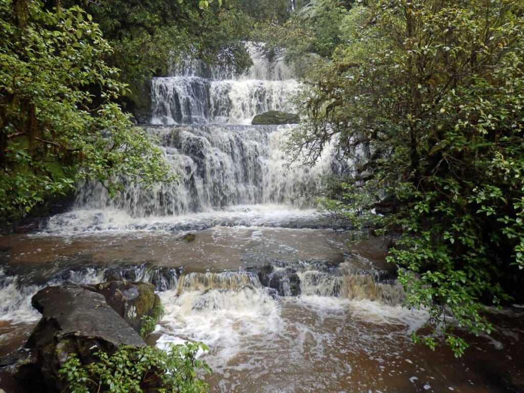
Where there is not farmland in the Catlins, there is forest, and the thickets of podocarp trees often hide rather majestic waterfalls. Of these, Purakaunui Falls is the prettiest. A 20 minute walk from the car park leads to a thundering river pouring over a rock wall in three main tiers. Turn the temperature up about 20 degrees, and it’d be the perfect setting for the sort of shampoo ad where a model emerges from the water to flick her hair around.

The walk to McLean Falls
McLean Falls, on the other hand, is more about the walk there. The trail ploughs through native bushland, the sweet scent of the manuka trees wafting in the air, until suddenly it starts to climb. Each set of greasy, rocky steps reveals another section to the cascades. What starts as a trickling noise builds to a roar.
It’s that mixture of beauty and untamed ferocity that makes the Catlins Coast so endearing, but there’s a fair bit of oddness thrown in too. At Curio Bay, where a surf school for masochists operates with admirably thick wetsuits, what initially appear to be rocks on the beach turn out to be something rather different.
The petrified forest of Curio Bay
It is petrified forest, a remnant of a time 170 million years ago when volcanoes were active in the region. Steady, heavy rain produced rivers of ash, mud and rocks and flooded forests. The gunk was rich in silica, which got into the trees, preserved them and effectively turned them into stone. Closer inspection shows the bark and branch-like markings, spreading out to the lapping sea.
Slope Point – the South Island’s southernmost point
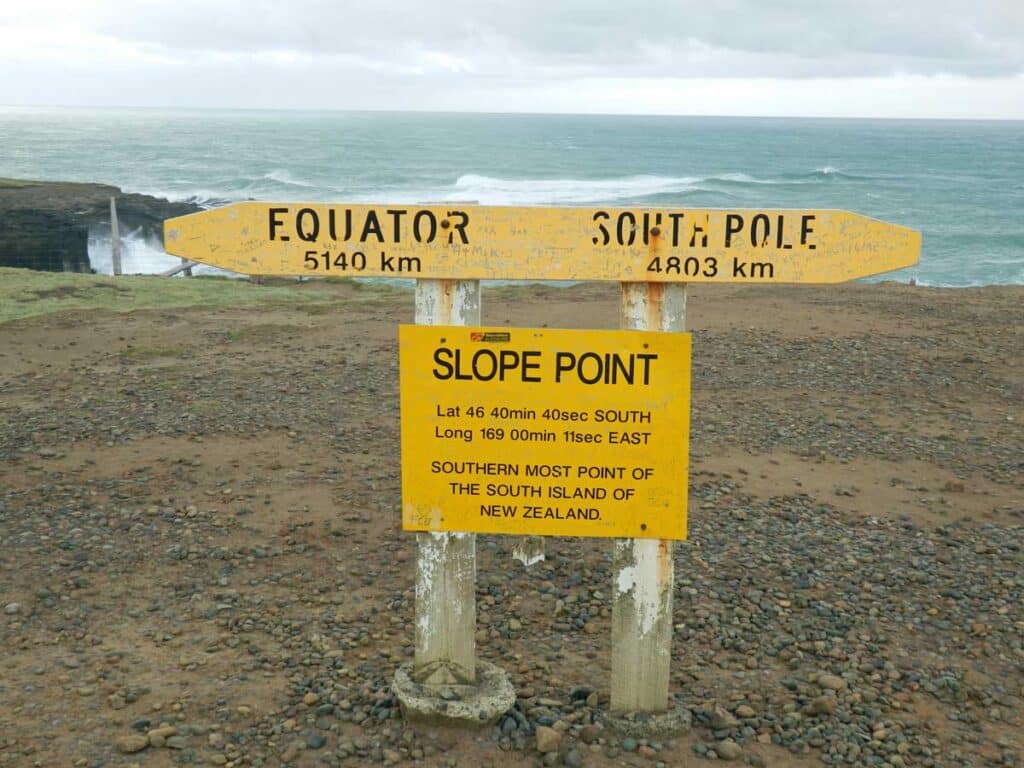
The final stop on the drive through to Invercargill is Slope Point, where a track crosses a blustery farm to the southernmost point on New Zealand’s South Island. Lambs gambol either side, but then comes the clifftop and a sign showing distances to other key points on the planet. The vast nothingness of the Southern Ocean is put into perspective by the numbers – the equator is only slightly further away than the South Pole. But that sense of detachment from the rest of the world is exactly what makes the Catlins worth the detour on a Kiwi road trip.

More New Zealand South Island ideas
If you’ve enjoyed this account of driving New Zealand’s Catlins Coast, there are plenty more New Zealand South Island articles on Planet Whitley. These include…
- Iceberg kayaking on Tasman Lake.
- What to do on the Christchurch to Oamaru drive before seeing Oamaru’s penguin colony.
- Braving sea-sickness on the Stewart Island ferry.
- The shocking story of New Zealand’s only castle.
- Why you shouldn’t do a day trip to Milford Sound from Queenstown.

